blah blah blah
White Cliff
Length: 6.1 miles out-and-back with loopDifficulty (click for info): Moderate
Elevation Gain: 1490 feet (loop total)
Rating (click for info): 6/10
Elevation: 2650' (highest outlook)
Driving Directions:
Parking area and trailhead are on the south side of Rt. 2 in Randolph, NH, one mile west of Pinkham B (Dolly Copp) Road and 7.1 miles east of the junction with Rt. 115. Look for the large lot with two entrances, which is almost always busy. It is also 5.3 miles west of Rt. 2's western junction with Rt. 16 (in the Upper Village of Gorham). Take note that on popular days and times, parking will overflow onto the sides of Rt. 2 for quite a distance. Click here for a Google Map.
About the Hike:
This longer loop hike utilizes some of the less frequented trails around the enormously popular Appalachia trailhead, where most serious hikers are bound for Mt. Adams and Mt. Madison and their AMC hut, or even more ambitious destinations beyond. There is quite the series of shorter walking paths around the lower slopes that tour some of the abundant waterfalls in the area, but not many visitors make it up to the series of scenic overlooks on the Cliffway trail. It is a boon for those desiring to avoid the crowds that this area retains a measure of solitude while being accessible from one of the White Mountains' top trailheads. The Cliffway trail is a bit remote and requires a substantial walk in, but it is rewardingly scenery-dense, making stops at three good viewpoints which take in rugged mountain terrain, and weaving through a stunningly lush and mossy evergreen forest. Hikers will also get a chance to view three beautiful waterfalls, including picturesque Coldbrook Fall.
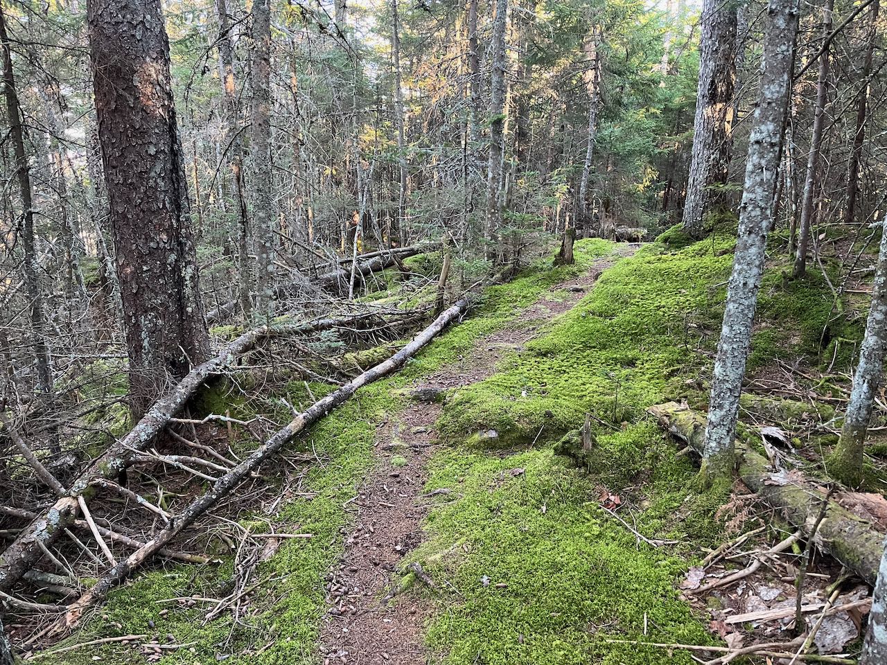
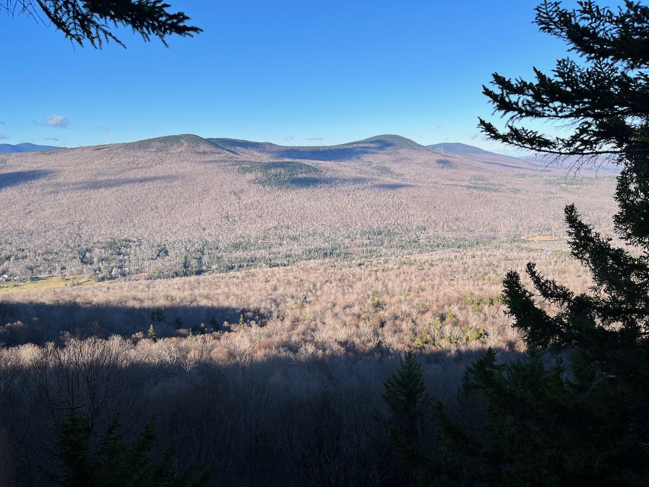
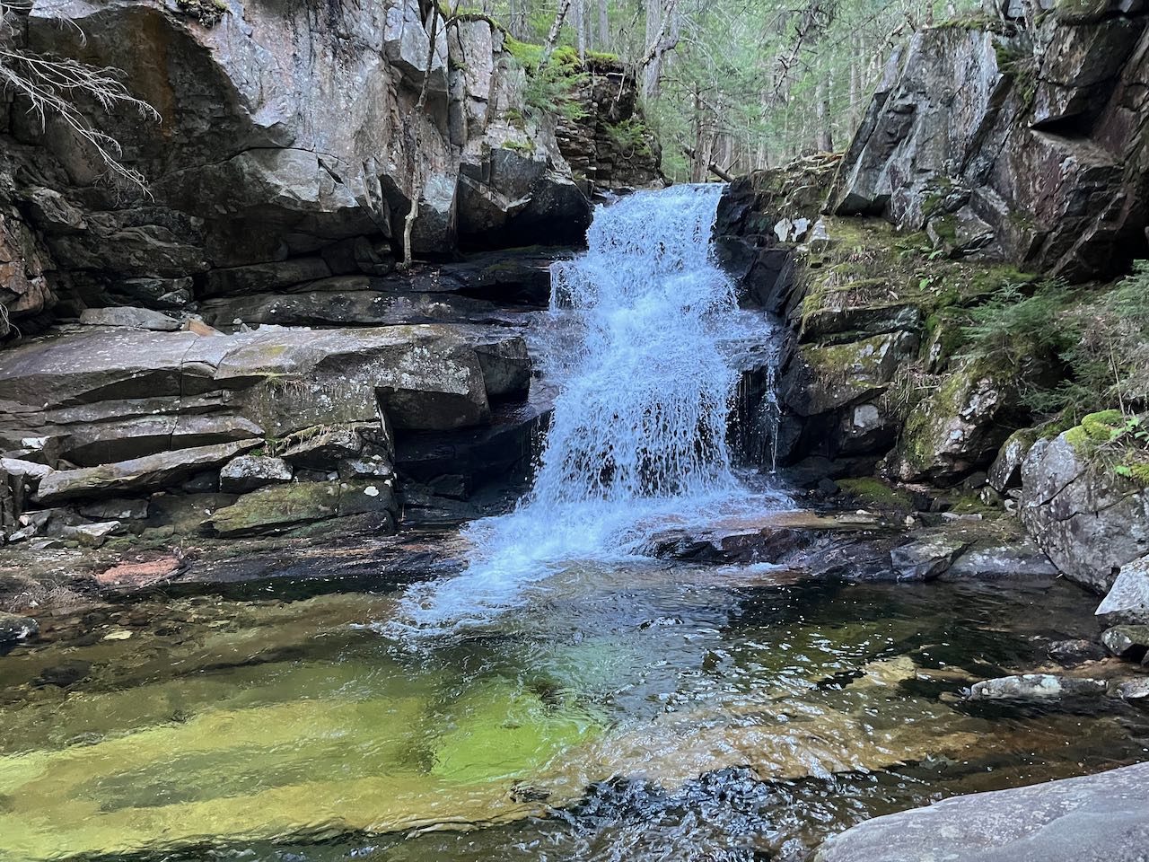
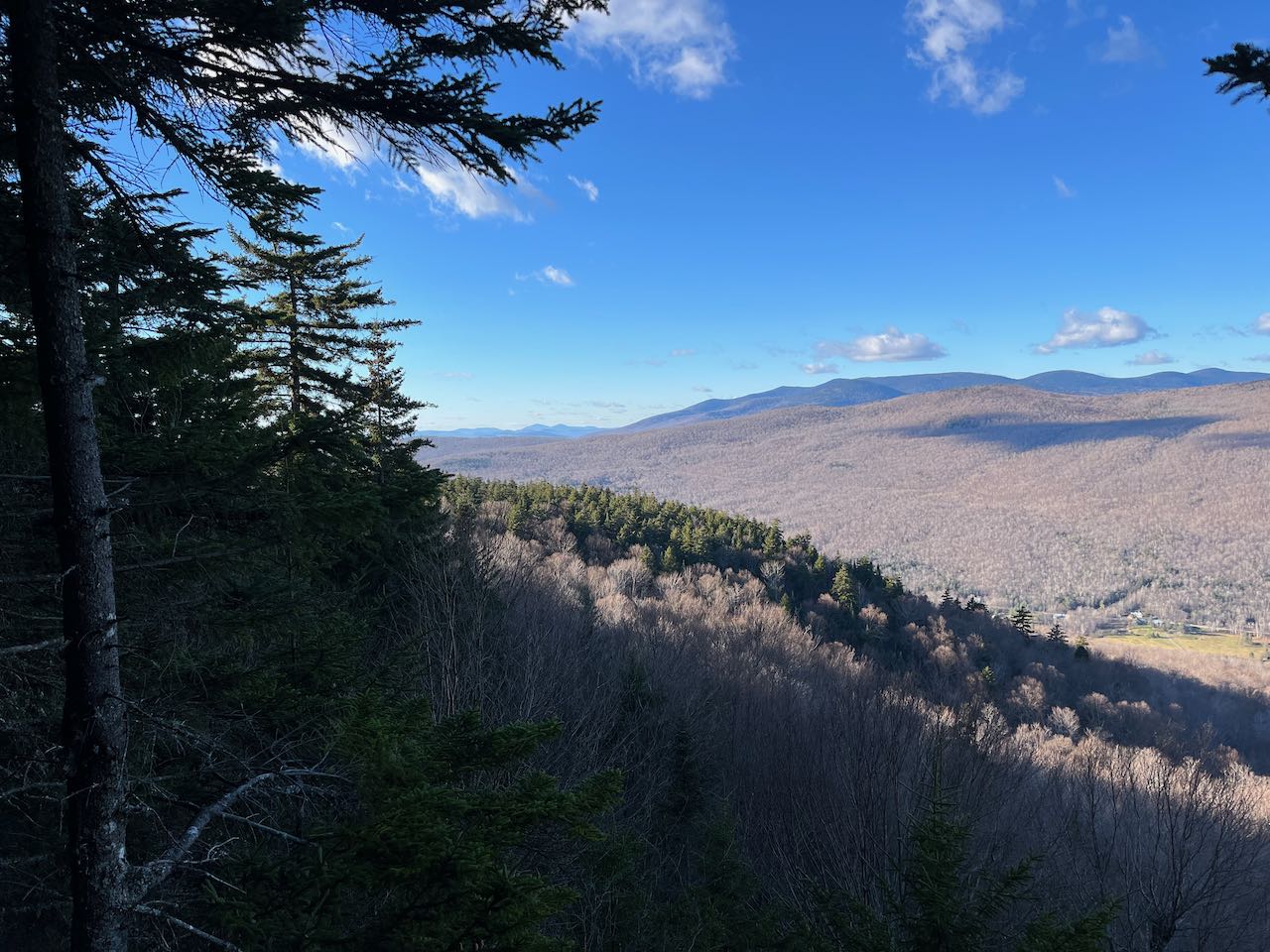
From the parking area, follow the trail from the big kiosk on the right to a junction in a power line clearing. Bear right onto Air Line, follow it into the woods, and take the next right onto The Link, which parallels the edge of the powerline clearing. Follow The Link through stands of short spruces to cross a small stony brook in 0.3 miles. Continue across level terrain, soon passing a saphouse, where maple sap flowing through the plastic lines overhead collects for storage. The trail continues amidst interwoven saplines, merging onto a woods road (watch for the right turn on the way back), then bearing right off it as Beechwood Way veers left. After 0.3 miles from the brook crossing, arrive at Memorial Bridge, a sturdy stone-and-wood crossing. On the bridge, you get your first view of Coldbrook Fall, a voluminous 40 foot plunge surrounded by a mossy and dark environment. Your descent route will take you right up close to it. For now, continue straight on The Link. You will loop back to this point on The Amphibrach, which turns left from this point. The trail makes a direct course across the hillside, sliding upward in elevation gradually. In 0.1 miles, it makes its next brook crossing on large stones. The steady plod is interrupted only by a chain of log bridges over a muddy section. The next brook is crossed 0.4 miles after the last, and another is encountered 0.1 miles after that. Not too far after this fourth and last crossing, the trail bends uphill a bit more and becomes steeper. After a long grind cutting upward across the hillside, arrive at the beginning of Cliffway 0.7 miles from the last brook. Turn left here, where you can finally expect the stimulating scenery to begin after the homogenous walk up The Link. The trail weaves through some boulders, then climbs moderately on a fern-lined pathway. In a quarter mile, the trail ducks into a darker spruce canopy and weaves across a thick carpet of moss. It turns back to the right, then makes a long curve to the left through a little hollow, where it crosses a smaller version of the last brook you crossed earlier. Cutting across a steeper hillside, you arrive at the trail junction above White Cliff after 0.35 miles. Use caution as you approach, as the sheer drop of the rock ledge careening down the hillside is not immediately evident. Stay a bit back from the brink as you enjoy the nice view across the valley to the Crescent Range. You see the summits of Mt. Randolph and Mt. Crescent on the right, and Mt. Waumbek and Mt. Weeks behind on the left.
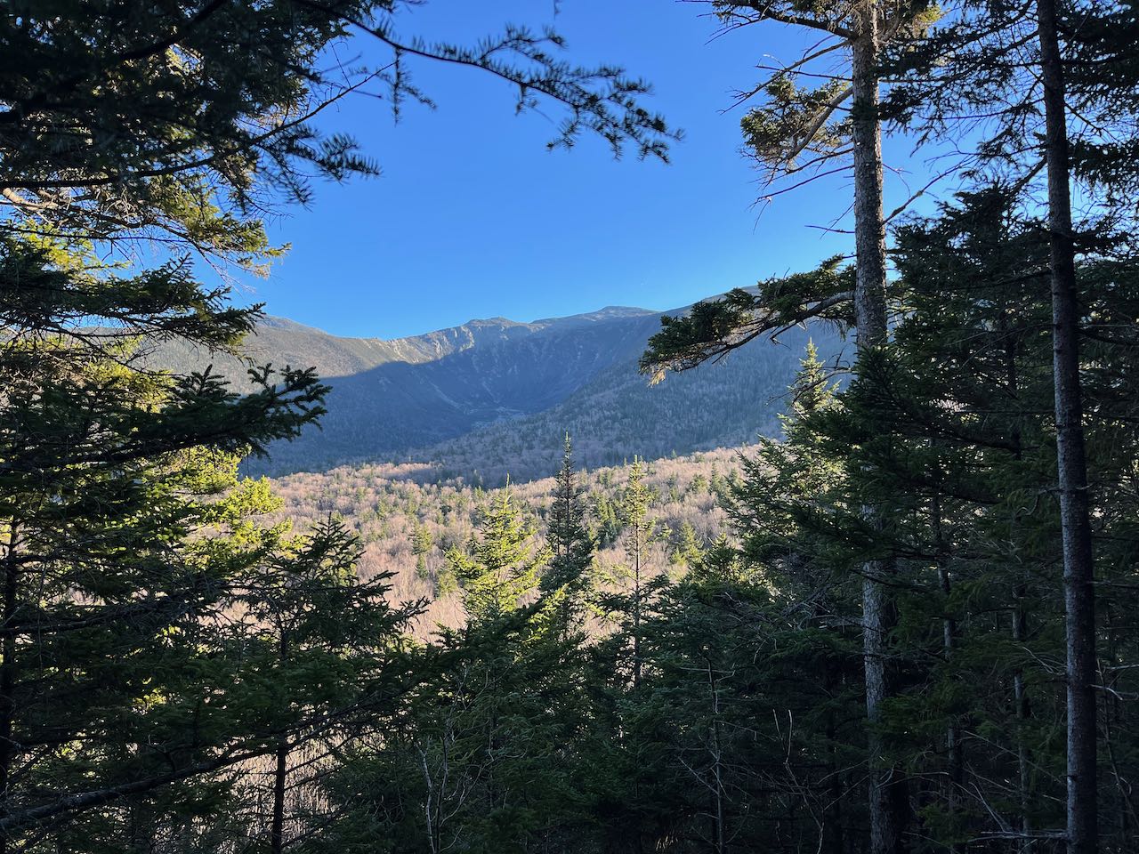
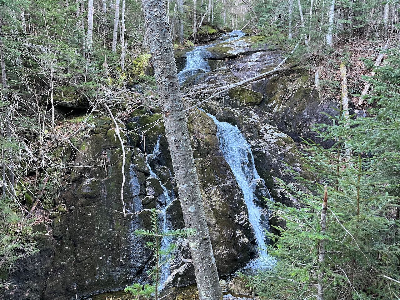
Take a right here, staying on Cliffway as it turns back uphill, leading through some more mossy woods. After a very winding 0.3 miles, the trail leads to the opening of Bog Ledge, the highest outlook on the trail. This point offers a view through the treetops across King Ravine to Mts. Madison and Adams, with the airy Durand Ridge leading down in the middle. The trail now descends from this point, making a couple switchbacks down to a small bog, which the trail crosses on a boardwalk. In just a quarter mile, the trail leads along a flat section past an opening called King Cliff, which reveals a narrower but more open version of the last view from Bog Ledge. Here you can really see the interior of King Ravine. A short distance past here, turn right to stay on Cliffway as the cut-through trail Monaway comes in from the left. The trail drops a bit, then contours across the hillside, crossing another one of the brooks you saw down on The Link and traversing a wet and mossy area with a few log bridges. In 0.4 miles from the junction, the trail arrives at the side of Spur Brook Fall, a tall multi-tiered cascade over mossy ledges. A clearing in the trees allows for an unobstructed view of the water, but it can't be approached from this side. The trail turns upstream, crosses a small and slimy feeder stream, then crosses the main brook just above the falls, allowing a view of the water sliding over the ledges from above. Continue 0.15 miles past the brook to arrive at a junction with The Amphibrach. Turn left and head back downhill here, as you are now on the last leg of the loop. The trail descends steadily for 0.35 miles to where it edges along the same brook, then crosses it with the aid of some larger rocks. A short distance after this, arrive at the other end of Monaway. Take a right onto a quick spur trail to see the next waterfall, the Coldspur Ledges. The viewpoint here is from the middle of a twofold waterfall, with the larger cascade below you and a pool in between the two. Continue down the trail, which now descends at an easy pace in the valley of Cold Brook. There is not much to see for the next mile as the trail makes a direct return to the junction at Cold Brook Fall. Just before arriving back at Memorial Bridge, you can take another spur on the right side to come right up close to Coldbrook Fall and experience its force pouring into the pool below.
Printable directions page